Most of my traveling is for photo shoots. Most of it. But every once in a while, I need to get away just to get away. You know, like everybody else. Oh, I’ll still bring the camera gear, just in case. But the idea is to go out with good friends, most of whom are not there for pre-dawn photo shoots or long backpacks into the backcountry, and just have a good time. Yeah, as appalling as this probably sounds to my photo shoot buddies, sometimes I need a break from the photo shoots. This July 4th (Independence Day in the U.S.) weekend was such a trip.
The Blue Mountains of eastern Washington and Oregon have been on my list of places to visit for quite some time. No, they didn’t have quite the allure of Iceland or Scotland or other places on my list, but they were on the list nevertheless. So when my road-trip buddy Janeen suggested we go there for the July 4th weekend, she didn’t have to twist my arm too hard.
The Blue Mountains are part of the Columbia River Plateau east of the Cascade Mountain Range. Several peaks in the Blues reach above 9,000 feet (2750 meters), so these are serious mountains. They have the distinction of being home to the world’s largest organism and fungal mycelial mat, the Armillaria solidipes, covering some 3.4 square miles (8.4 km²). They don’t call it the Humongous Fungus for nothing!
Anyway, our plan was to follow the Blue Mountain Scenic Byway from the Columbia River deep into the Umatilla National Forest, ending at the North Fork John Day Campground on the edge of the North Fork John Day River. As I pointed out in a recent article, “There’s Gold in Them Thar Hills!”, in spite of just about everything in northeast Oregon being named, either directly or indirectly, after John Day, a hunter and trapper from the early 1800s, he is best known for being robbed and stripped naked by Indians on the Columbia River near the mouth of the river that now bears his name. Some days are like that.
Well, both of us having crazy busy weeks, neither Janeen nor I were anxious to do what would have been necessary to leave the Seattle area at anything close to a reasonable hour on Thursday morning, so while we did manage to penetrate the western edge of the Umatilla National Forest just prior to sunset, we were nowhere close to our goal. No problem. We’ll just stop at the first campground we find and call it a day. Well, the first campground was, um, interesting. First of all, it was completely empty. Secondly, it was essentially a huge, round, parking lot with three campsites around the perimeter and a trailhead leading off to a cave or something. Seriously, the parking lot to campsite ratio was about 100 to 1! We later figured out that this is where OHV/ATV (Off Highway Vehicle/All Terrain Vehicle) riders drop off their excess trucks, campers, and whatnot and head onto the area’s trails. As for camping, July 4th weekend or not, there wasn’t much of that happening here.
Well, we set up our tents, had dinner, and watched the almost half-moon disappear over the horizon. This area being away from most sources of light pollution, I had boldly promised Janeen an appearance of the Milky Way that night, and sure enough, it appeared right on schedule.
The next day we continued on the Blue Mountain Scenic Byway to our destination at the North Fork John Day Campground. This campground, unlike the first, was almost entirely full with RV campers, but we managed to find what we thought was the best site in the campground, lucky number 13, and again set up camp. While we followed all the rules and registered and paid for our campsite, we didn’t have the site entirely to ourselves. It seems there were some squatters in the site, one of which was actively enlarging his residence almost before our eyes, though he was sneaky enough that we never actually saw him.
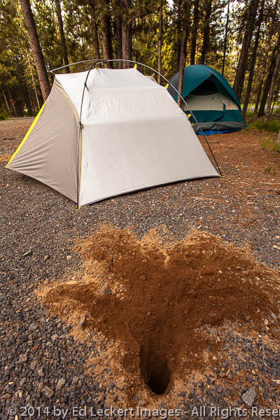
Something quite large has burrowed beneath this campground, in the Omachilla National Forest, Oregon.
Janeen wanted to meet the camp hosts, so we walked over to their campsite, which I though looked more like a farmers’ market than a campsite with all the fruits and vegetables on display under their shelter. There we met Charlie and his wife, a friendly couple from Ontario, Oregon. It seems they had been hosts at this campground for the past fourteen years, living essentially half the year in their RV and the rest in their home in Ontario. Wow. Anyway, the told us of all the interesting places to visit in the area, including Cabell City, a ghost town that had never been much more than a gold mining camp to the Cabell family, hidden away on an unmarked side road. There we visited the cemetery where Fred Cabell, his wife Johanna, and their eight year old daughter are all buried. Then we proceeded into the “city”, where the remains of the mill stand in fairly good condition as trees and other vegetation fight to regain control of the area.
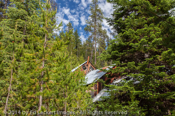
The mill that belonged to the gold mining camp of Cabell City, now a ghost town in the Umatilla National Forest, Oregon.
After that, a hike along the river was next. Charlie had told us of a swimming hole downstream a bit, but we were certain Charlie would never have been quite so daring as to jump into this raging river of near-freezing water. We did, however, manage to dangle our feet in the water for a bit, deciding that to accidentally slip into these raging waters would not result in a pleasant outcome.
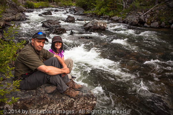
Ed and Janeen relax on a rock on the banks of the North Fork John Day River, in the Omatilla National Forest, Oregon.
While on the trail, we walked past a huge pile of material that we determined to be fur from a very large animal, such as a deer or an elk – or could it be – Sasquatch??? We saw no other evidence of the animal, such as bones, so we headed back to the campground. There we decided to check out the walk-in tent sites, and what do you suppose we found there? Tent campers? Oh, no. We found bones! We’re not sure if they were from the same animal, but they weren’t more than a quarter of a mile from the site of the fur. We found some bones on the ground, but we also found parts of a skull, jaw, and perhaps pelvis hanging from trees in the middle of the campsite. No wonder no one stayed there!
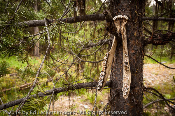
Someone has decorated the trees in this campsite with the ramains of a large animal, in Umatilla National Forest, Oregon.
Janeen decided to do a little video tour of the campsite. Janeen can be quite entertaining, so check it out here!
I should point out that on July 4th, a day (and night) usually filled with explosions of fireworks, we didn’t hear a single pop, boom, or fizzle. Fireworks are illegal in the National Forests due to the danger of starting a forest fire, and no one within miles of us was shooting any off. It was quite nice, actually.
Our last day we went wine tasting in Walla Walla, Washington, a premier wine producing region. Walla Walla is famous as the home of the Washington State Penitentiary, Walla Walla Sweet Onions, Whitman College, and wine. For a small town, it has a lot going on! Anyway, if you have a chance to visit Walla Walla for wine tasting, do it – you won’t be disappointed.
Finally, it was time to head back to Seattle. Concerned that traffic at the end of a holiday weekend would be as horrible as it was on my Memorial Day weekend trip, I elected to take the scenic route over Cayuse Pass using State Route 410 instead of the clogged I-90 over Snoqualmie Pass. There was almost no traffic on 410, so I was pretty happy with my decision – and then Mount Rainier came into view. Wow! The evening light on the clouds surrounding the mountain was spectacular. I wasn’t able to stop the car and start shooting before the light started to fade, but I did get off a few shots before it was completely gone.
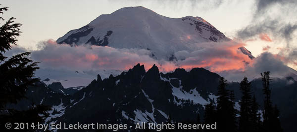
Late aftenoon light turns the clouds over Mount Rainier a bright orange, in Mount Rainier National Park, Washington.
After that, the trip almost over, Janeen got really quiet, sad that another fun road trip was coming to an end. But there will be others, I’m sure, and even if it’s not a “photo trip”, I’ll try to remember to take a few shots. Hey, maybe we’ll even go on a Sasquatch hunt some day!

So fun to read! Can’t wait to get together and hear more about it.
Sounds like a great get-a-way! Love the Mt. Rainier shot.